HYDROGRAPHIC SURVEYS
Hydrographic Surveys
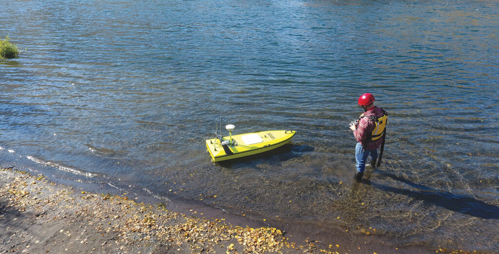
Hydrography is a branch of surveying which deals with any body of still or running water such as a lake, harbor, stream or river. Hydrographic surveys are used to define shore line and underwater features. Our surveyors operate in nearly any body of water, from the shallowest of waters, lakes, bays, to riverine environments. Statewide is trained and equipped for both manned and unmanned data collection. For example, as an important part of our unmanned capability, we now deploy a CEE-USV™, a state-of-the-art, unmanned survey boat incorporating a single beam echo sounder, GNSS positioning, live video, and on-board data management. Designed for shallow water surveying, the CEE-USV allows the collection of much higher data quality and quantity, all while mitigating risk to our field teams.
Applications
Reasons for a Hydrographic Survey: • River and estuarine restoration • Tidal measurement as it effects habitat or sea defense works • Determination of direction and flow of current in connection with flood plain or construction interests • Determination of light filtering from surface to bottom in connection with biosphere considerations
Other Statewide Hydrographic Survey Projects
Columbia River Estuary Task Force (CREST) – Clatskanie River, Clatsop County, Oregon Mt Hood Environmental – Early Winters Creek, Okanagon, Washington Pacific Northwest National Laboratory – Grays River, Grays River, Washington Cascade Environmental Group – Youngs Bay / Wallooski River, Clatsop County, Oregon USACE Portland District – Willametter Valley Flood Study, Oregon
FEATURED PROJECT
Hydrographic Mapping of the Multnomah Channel
SWLS provided services to ESA for the hydrographic mapping of the Multnomah Channel near the south tip of Sauvie Island. The objective of the project was to provide information to help with the restoration of Miller Creek to its original path. The hydrographic portion of the survey supplemented the land survey topography mapping. On this survey, our 16’ shallow water sled was used with a Trimble RTK GPS. The Hydrolite sonar unit was also used, streaming depth values into a TSC3 data collector at a rate of 2 Hz. The depths were then subtracted from the RTK X, Y, and Z position of the transducer. A bar check was performed two times a day to adjust the sound velocity in the sonar measurements.